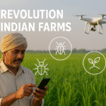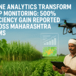


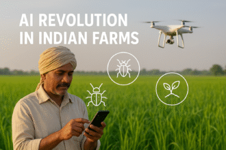
Agricultural drones are revolutionizing crop monitoring in Maharashtra, delivering unprecedented efficiency gains and transforming farm management practices. Recent studies indicate a 500% improvement in monitoring efficiency compared to traditional methods, while providing more accurate and actionable insights for farmers across the state.
The Traditional Monitoring Challenge
Traditional crop monitoring methods face significant limitations in Maharashtra’s diverse agricultural landscape. Manual field surveys require substantial time and labor resources. A typical 100-acre farm needs 3-4 days for comprehensive monitoring using traditional methods. Seasonal labor shortages compound the problem, particularly during critical growth stages.
Human observation limitations affect monitoring accuracy. Subtle stress indicators often go undetected until significant damage occurs. Disease identification depends on individual expertise levels. Pest detection rates vary dramatically among scouts. Inconsistent monitoring schedules miss critical intervention windows.
Coverage limitations restrict comprehensive assessment. Remote field sections receive inadequate attention. Difficult terrain limits accessibility. Weather constraints interrupt monitoring schedules. Large farms require extensive human resources for adequate coverage.
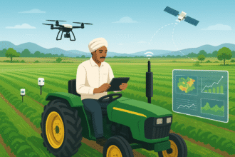
Drone Technology Revolution
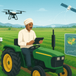
Drone-based crop monitoring addresses traditional limitations through advanced sensors and automated analysis. High-resolution cameras capture detailed field imagery. Multispectral sensors detect stress indicators invisible to human eyes. Thermal cameras identify water stress and disease hotspots. LiDAR systems measure crop height and biomass.
Flight automation ensures consistent coverage and timing. Predetermined flight paths maintain uniform data quality. Automated scheduling enables regular monitoring cycles. Weather-responsive systems optimize flight timing. GPS precision ensures accurate georeferencing.

Data processing capabilities provide actionable insights. Machine learning algorithms identify crop health issues. Automated counting systems monitor plant populations. Change detection algorithms track growth progression. Prescription mapping guides variable-rate applications.
Maharashtra Implementation Success
Maharashtra’s drone monitoring program launched in 2023 across 15 districts, covering 500,000 hectares initially. Program expansion reached 1.2 million hectares by 2024. Over 25,000 farmers participated in the program. Results demonstrate remarkable efficiency improvements.
Monitoring time reduced from 3-4 days to 4-6 hours per 100 hectares. Data accuracy improved by 85% compared to manual methods. Issue detection advanced by 5-10 days on average. Treatment precision increased through targeted applications.
State government support accelerated adoption. Subsidies covered 60% of equipment costs for farmer groups. Training programs certified 500 drone pilots. Service centers provided technical support across all districts.
Multispectral Imaging Breakthroughs
Multispectral cameras capture light wavelengths beyond human vision, revealing critical crop health information. Normalized Difference Vegetation Index (NDVI) maps show plant vigor variations. Red-edge indices detect early stress symptoms. Chlorophyll content maps guide fertilizer applications.
Disease detection capabilities are remarkable. Fungal infections appear in imagery 3-7 days before visible symptoms. Bacterial diseases show distinct spectral signatures. Viral infections create characteristic patterns. Early detection enables preventive treatments.
Nutrient deficiency identification supports precision fertilization. Nitrogen deficiency appears as reduced chlorophyll content. Phosphorus shortage shows specific spectral patterns. Potassium deficiency creates distinctive signatures. Micronutrient problems become visible before symptoms appear.
Thermal Imaging Applications
Thermal cameras reveal water stress patterns invisible to conventional imaging. Canopy temperature variations indicate irrigation needs. Stressed plants show elevated temperatures 2-4 hours before wilting occurs. Drainage problems appear as cool spots in thermal maps.
Irrigation optimization benefits from thermal monitoring. Soil moisture variations become visible through temperature differences. Over-watered areas show cooler temperatures. Under-irrigated sections appear warmer. Variable-rate irrigation systems use thermal data for precise water application.
Disease hotspots often generate heat signatures. Fungal infections create localized temperature increases. Bacterial diseases show elevated thermal readings. Root rot problems appear as temperature anomalies. Early thermal detection enables targeted interventions.
Precision Agriculture Integration
Drone data integrates seamlessly with precision agriculture systems. Variable-rate application maps guide fertilizer spreaders. Seed placement recommendations optimize plant populations. Pesticide application maps target specific problem areas. Harvest planning uses maturity maps for timing decisions.
GPS technology ensures precise data georeferencing. Field boundaries maintain accurate positioning. Treatment areas receive precise mapping. Historical comparisons track field changes over time. Integration with farm management systems streamlines operations.
Automated equipment responds to drone-generated prescriptions. Variable-rate spreaders adjust application rates automatically. Precision sprayers target identified problem areas. Automated irrigation systems respond to water stress maps. Harvesting equipment follows maturity guidance.
Case Study: Nashik Grape Vineyards
Nashik’s grape industry exemplifies successful drone monitoring implementation. Vineyards covering 50,000 hectares participate in drone monitoring programs. Results show significant improvements in quality and yield.
Disease detection improvements are substantial. Downy mildew detection advanced by 10 days through spectral analysis. Powdery mildew identification improved by 7 days. Black rot detection enhanced by 5 days. Early detection reduced fungicide applications by 30%.
Yield prediction accuracy increased to 92% using drone imagery. Machine learning models analyze canopy density, fruit count, and growth patterns. Harvest timing optimization improved grape quality scores by 15%. Market planning benefits from accurate yield forecasts.
Water management optimization reduced irrigation costs by 25%. Thermal imaging identified over-watered and under-watered sections. Variable-rate irrigation systems adjusted water application accordingly. Grape quality improved through optimal water management.
Sugarcane Monitoring Revolution
Maharashtra’s sugarcane industry benefits significantly from drone monitoring across 1 million hectares. Crop growth tracking helps optimize harvest timing. Pest detection identifies shoot borer infestations early. Disease monitoring tracks red rot and smut infections.
Growth monitoring provides valuable insights. Plant height measurements track development progress. Canopy density maps identify thin stands. Maturity assessment guides harvest scheduling. Yield estimation improves mill planning.
Pest and disease management improves dramatically. Early shoot borer detection saves 15-20% yield losses. Red rot identification enables variety replacement decisions. Viral disease mapping guides replanting strategies. Integrated pest management becomes more precise.
Cotton Crop Applications
Cotton monitoring demonstrates exceptional results across 800,000 hectares in Maharashtra. Bollworm detection advances by 5-7 days using spectral analysis. Whitefly monitoring tracks population levels accurately. Disease detection identifies bacterial blight early.
Defoliation timing optimization improves harvest efficiency. Drone imagery determines optimal defoliation spray timing. Machine harvesting benefits from uniform crop preparation. Harvest scheduling reduces weather-related losses.
Quality assessment capabilities are developing rapidly. Fiber development monitoring guides harvest decisions. Contamination detection identifies problem areas. Grade prediction models use imagery analysis. Premium pricing results from quality optimization.
Vegetable Crop Monitoring
Vegetable crops show remarkable benefits from drone monitoring. Onion crops covering 200,000 hectares participate in monitoring programs. Tomato cultivation uses drone data for disease management. Potato crops benefit from blight detection systems.
Growth stage monitoring optimizes input applications. Transplant establishment rates improve through early detection of gaps. Flowering patterns guide pollination management. Fruit development tracking improves harvest timing.
Disease pressure mapping enables targeted treatments. Blight detection systems provide early warning. Viral disease identification guides plant removal decisions. Bacterial infection mapping reduces spread through targeted interventions.
Economic Impact Analysis
Economic benefits from drone monitoring are substantial across Maharashtra. Input cost savings average ₹8,000-15,000 per hectare annually. Yield improvements add ₹12,000-25,000 per hectare value. Quality premiums provide additional ₹5,000-10,000 per hectare.
Cost-benefit analysis shows attractive returns. Drone service costs range from ₹800-1,500 per hectare per season. Benefits average ₹25,000-50,000 per hectare annually. Return on investment ratios range from 15:1 to 35:1.
Labor cost reductions are significant. Monitoring labor requirements decrease by 75%. Scouting accuracy improves while reducing human resource needs. Automated analysis eliminates subjective variations.
Technology Service Models
Multiple service models accommodate different farmer needs. Custom service providers offer comprehensive monitoring packages. Farmer cooperatives purchase equipment for shared usage. Equipment rental models provide seasonal access.
Service pricing varies by complexity and frequency. Basic crop health monitoring costs ₹500-800 per hectare. Advanced analytics with recommendations cost ₹1,200-1,800 per hectare. Comprehensive precision agriculture packages range from ₹2,000-3,500 per hectare.
Training and support services ensure successful adoption. Pilot certification programs prepare operators. Data interpretation training helps farmers use insights effectively. Technical support maintains equipment performance.
Regulatory Framework Development
Government regulations balance innovation with safety requirements. Drone licensing processes are streamlined for agricultural applications. No-fly zone restrictions exempt agricultural operations. Privacy concerns are addressed through operational guidelines.
Insurance frameworks support commercial operations. Equipment insurance covers drone losses. Liability coverage protects operators from third-party claims. Crop insurance integrates drone monitoring data.
Certification standards ensure service quality. Equipment calibration requirements maintain data accuracy. Operator certification programs ensure safe operations. Service provider accreditation builds farmer confidence.
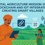
Integration with Government Programs
Government schemes increasingly incorporate drone monitoring. PM-KISAN beneficiaries receive subsidized drone services. Crop insurance programs use drone data for claim verification. Soil health cards integrate drone-based nutrient mapping.
Digital agriculture initiatives support drone adoption. Infrastructure development improves rural connectivity. Data management platforms integrate various monitoring systems. Training programs build technical capacity.
Research collaborations advance technology development. Agricultural universities conduct validation studies. ICAR institutions develop new applications. International partnerships bring global expertise.
Challenges and Solutions
Technical challenges require ongoing attention. Weather limitations affect flight operations during monsoons. Data storage and processing needs substantial infrastructure. Equipment maintenance requires technical expertise.
Solutions emerge through systematic approaches. Weather-resistant equipment designs improve operational reliability. Cloud computing platforms handle data processing needs. Local service networks provide maintenance support.
Farmer adoption challenges include initial cost barriers and technical complexity. Solutions include cooperative purchasing models, simplified interfaces, and comprehensive training programs.
Future Technology Developments
Emerging technologies promise enhanced capabilities. Artificial intelligence improves automated analysis accuracy. Hyperspectral imaging provides more detailed crop information. Real-time processing enables immediate decision-making.
Autonomous systems reduce operational costs. Self-charging stations enable continuous operations. Automated flight planning optimizes coverage efficiency. Swarm operations coordinate multiple drones simultaneously.
Integration possibilities expand solution value. Satellite data combination provides broader coverage. Ground sensor networks add detailed monitoring. Weather station integration improves analysis accuracy.
Market Expansion Opportunities
Maharashtra’s success creates replication opportunities. Other Indian states show strong interest in similar programs. International markets seek proven agricultural drone solutions. Equipment export opportunities emerge from successful implementations.
Technology development creates intellectual property value. Software algorithms become exportable products. Service methodologies support international consulting. Training expertise enables capacity building projects.
Investment opportunities attract venture capital. Service companies show strong growth potential. Equipment manufacturers benefit from expanding markets. Data analytics companies find new revenue streams.
Environmental Impact
Environmental benefits complement economic gains. Reduced chemical usage through precision applications. Water conservation through optimized irrigation. Soil health improvement through precise nutrient management.
Carbon footprint reduction results from efficiency improvements. Reduced fuel consumption from targeted applications. Lower manufacturing needs through input optimization. Improved soil carbon through better management.
Biodiversity conservation benefits from precision pest management. Reduced non-target species impact from selective treatments. Habitat preservation through sustainable practices. Pollinator protection through targeted applications.
Knowledge Transfer and Training
Training programs ensure effective technology adoption. Farmer education covers interpretation of drone data. Technical training prepares service providers. Academic programs integrate drone technology into agricultural education.
Knowledge sharing platforms facilitate learning. Online portals provide training resources. Peer networks share experiences and best practices. Regular workshops update knowledge on technological advances.
International knowledge exchange accelerates development. Study tours expose farmers to global practices. Technical collaborations bring advanced capabilities. Research partnerships advance innovation.
The 500% efficiency gain from drone analytics in Maharashtra represents a transformation in agricultural monitoring. This technology revolution enables more precise, timely, and cost-effective crop management while supporting sustainable farming practices. As adoption expands and technology continues advancing, drone monitoring will become an indispensable tool for modern Indian agriculture.